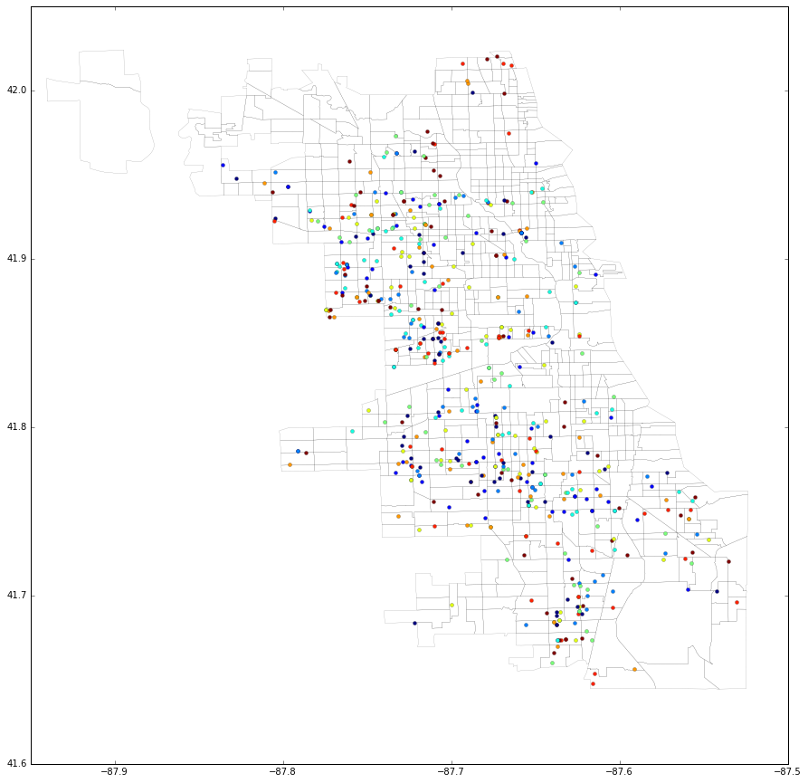
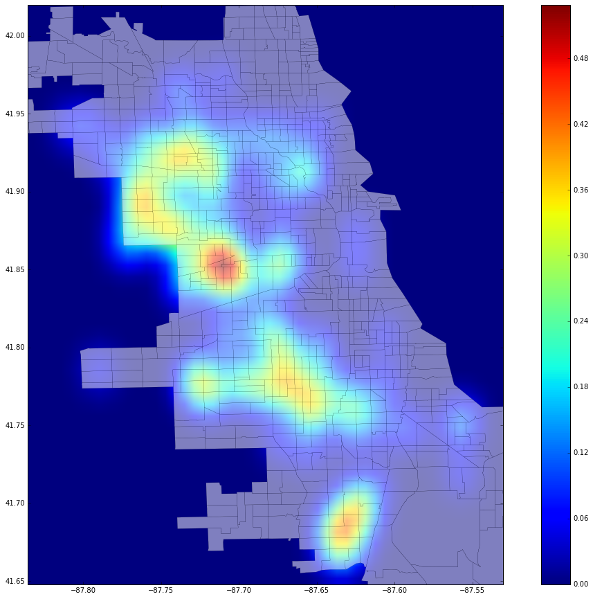
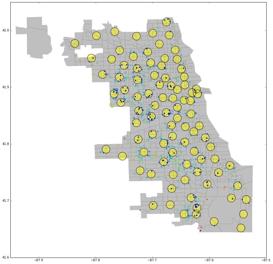
One of the things Chicago is known for (aside from its now WORLD SERIES CHAMPION CUBS) is the Great Chicago Fire of 1871, an event that decimated the city’s existing building stock and irrevocably altered the trajectory of the city’s development and growth. After looking through the crime data that the city hosts on its Open Data portal, it appears the city still has a pretty significant issue with fire. The following maps show the locations for all of Chicago’s arson cases between the two most recent Halloweens, October 31, 2015 and October 31, 2016. The first is a simple scatter plot over the a Census tract shapefile, while the second map gives us a better idea of the spatial intensity of arson incidents in the city through a heat map. Finally, map number 3 shows the location of each fire relative to the city’s fire stations. The color ramp on arson dots in the final map indicates the relative distance between each incident and the nearest station. It’s interesting to note how evenly distributed these stations are, with the only notable concentration occurring downtown. It looks like the city could probably stand to locate an extra station or two on the city’s West Side, where a large proportion of the activity takes place.


